Lomonosov Ridge, One of the most mysterious mountain ranges in the world.
- July 26, 2020
- 0
Cover Image Credits: BBC News
Prepared by Mario Fares
The article appeared first on BBC News
Beneath the frozen Arctic, a three-way geopolitical war is taking place over which country owns a ridge of undersea mountains. The winner will change maps forever.
One of the most mysterious mountain ranges in the world is not visible on any ordinary map. The mountain range stretches for more than 1,700 km, its highest peak is 3.4 km above the ocean floor.
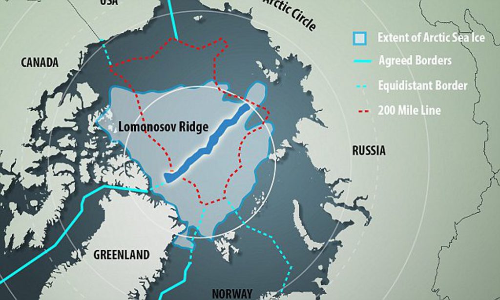
This little-known mountain range is at the center of three nations seeking sovereignty. According to Denmark, the mountain range is an extension of its autonomous territory of Greenland. According to Russia, it is an extension of the Siberian archipelago Franz Josef Land. And according to Canada, it is an extension of Ellesmere Island in the Canadian territory of Nunavut.
So who is right?
The quest to map the ocean floor
The ridge was first discovered in 1948 by researchers on one of the Soviet Union’s early expeditions to the central Arctic. It was the first hint that the ocean was split into two basins by the ridge, rather than being one large basin, as previously assumed. In 1954, the researchers published a map showing an underwater mountain range, which they named after the 18th-Century poet and naturalist Mikhail Lomonosov, who had predicted 200 years before that such features would be found in the Arctic basin.
In such a poorly charted area, new mapping expeditions always lead to surprises.
But mapping the peaks and valleys of this mountain range alone isn’t enough to determine how it formed. To do that, scientists need to physically get hold of a piece of the ridge.
Hard evidence
Scientists have dredged rocks from around the mountain range, but the difficulty is always proving that what they’ve picked up is really a part of the ridge, rather than just some pebbles or boulders lying around that could have come from anywhere.
But it is hard to take a piece out of a mountain range that is submerged beneath hundreds of metres to several kilometres of water, topped with floating sea ice.
Knudsen’s team were able to dredge the ridge at a depth of 3 km . Among the rocks they drew back to the surface was an orange-colored lump around the size of a rugby ball. “In the beginning no one paid attention to this rust-orange-brown crust, but I was curious to see what it was,” says Knudsen. “So we cut it.”
Inside he found something unexpected: layer upon layer of fine lines, much like tree rings. This layered crust was rich in manganese oxide, which forms in nodules on the seafloor where there is very little sediment. The nodules take many thousands of years to form, so it was a hint that the rock that had formed in-situ at the ridge, and was not a drop stone.
What he found was a steady eight-million-year timeline of the rock’s history through the many layers of the crust, with the oldest rock next to a base layer of sandstone at the bottom, and the outer layer very recent.
“It proved that this rock has been sitting in this position for eight million years in the polar basin – since before the Ice Age,” says Knudsen.
But it was sandstone below the rust-orange crust that had the most interesting information about the mountain range. The lines formed in this rock were folded, a signature mark of sandstone that has been crumpled in a mountain-building event. It turned out the mountain-folding event was 470 million years ago. The sand grains that made up the rock, though, were much older, closer to 1.6 billion years.
Why mountains matter
As coastal nations, Russia, Denmark and Canada of course already have sovereign rights over the seafloor close to their own shores. Coastal countries can establish an Exclusive Economic Zone that stretches up to 200 nautical miles (370km) from shore, which gives them rights to activities like fishing, building infrastructure and extracting natural resources, under the UN Convention on the Law of the Sea. That law also permits a country to extend its rights over the seabed further – if there are seafloor features that they can prove are an extension of their continental shelves.
Redrawing the map
The Lomonosov Ridge is central to each of the submissions Russia, Denmark and Canada have made to the UN Commission on the Limits of the Continental Shelf. As long as there is land at a depth of no more than 2,500 m extending as a continental feature from a country’s established shelf, it can act as a spine for extending their territory. When three countries use the same spine of submerged land, it results in several areas of overlap. That includes a 54,850 square nautical mile area around the North Pole all three countries lay claim to.
So, what next? Does that mean these three Arctic nations are due to clash over territorial disputes?
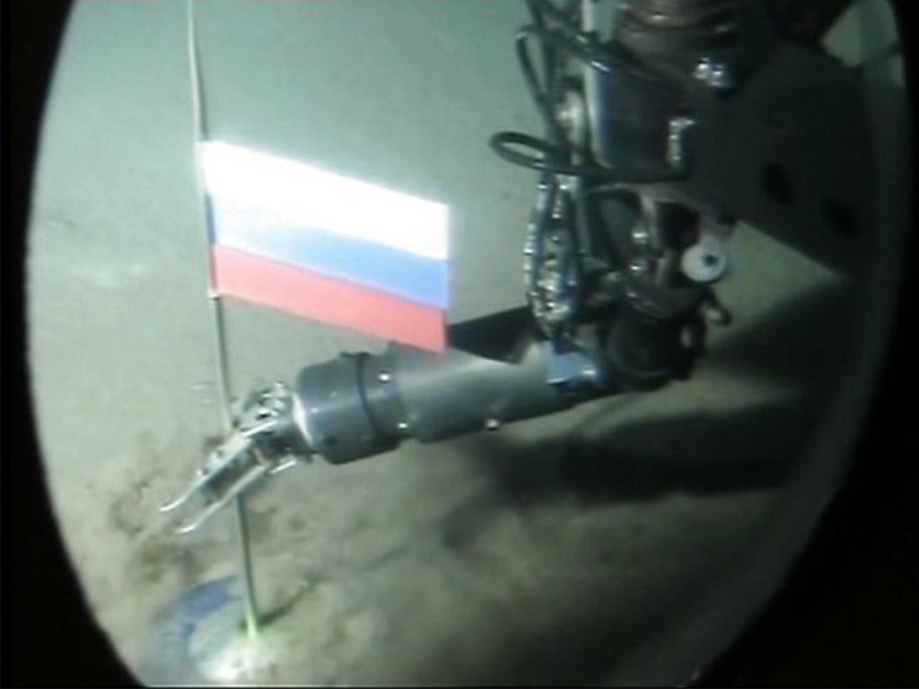
The answer is almost certainly not. These three countries have committed to a peaceful and cooperative means of drawing their lines on the map in ratifying the UN Convention on the Law of the Sea. The “Arctic Five”, which includes the US and Norway, also signed a declaration in 2008 committing to orderly settlement of Arctic borders, which helped to deescalate matters after Russia planted a flag at the North Pole seabed the year before