Wakhan Corridor.. few people even know of its existence!!
- August 11, 2023
- 0
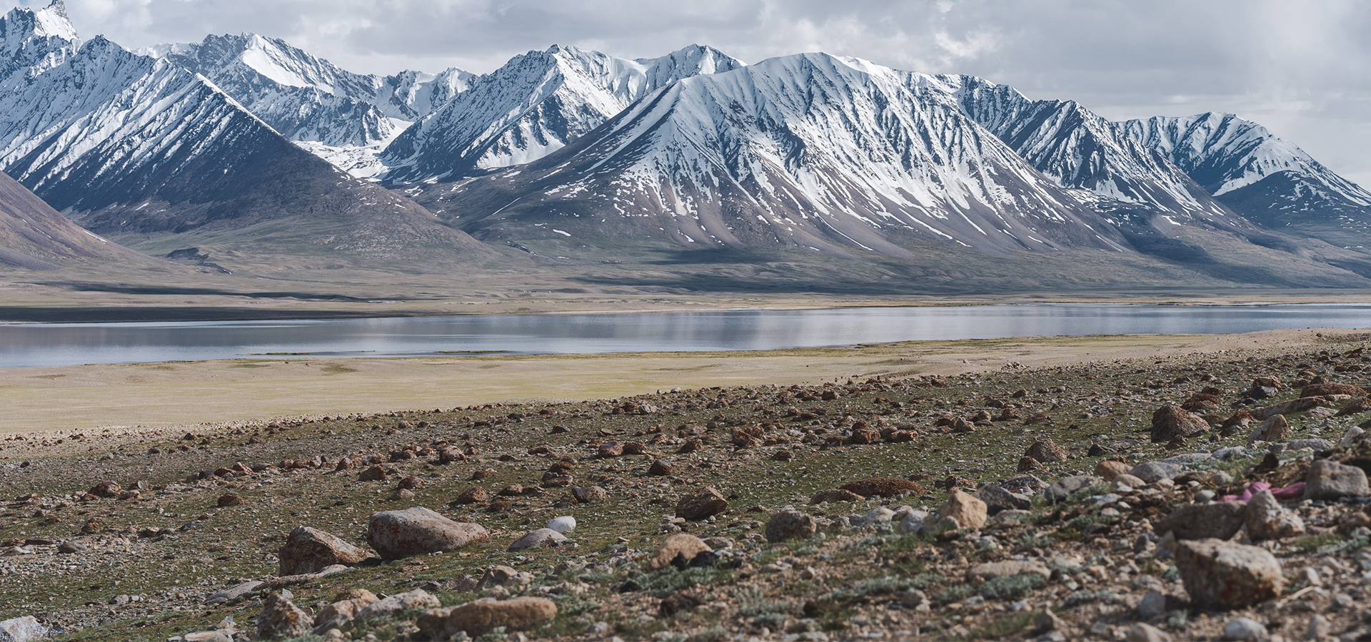
It’s undoubtedly one of the remotest, and most beautiful places in the whole world and it is about as far away from the noise & the traffic as heaven…
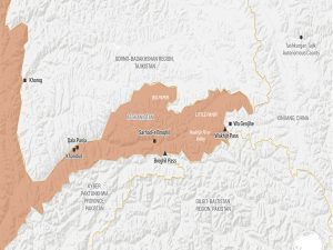
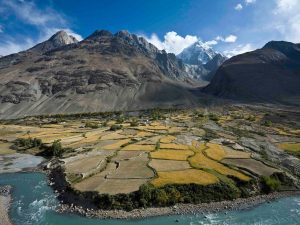
The Wakhan Corridor, a narrow strip of territory in the Badakhshan Province of Afghanistan, is situated at the crossroads of four countries: China, Pakistan, Afghanistan and Tajikistan. The Wakhan Corridor is a panhandle 350km long but less than 15 km wide, ending in Afghanistan’s short border with China that measures just 75km across. It was created by Russo-British negotiations in 1895, resulting in a commission that designated the valley as a buffer zone between the two empire’s territories—nominally administered by the emir in Kabul.
To the Corridor’s north lies the Tajikistani region of Gorno-Badakhshan, the site of a small but fierce civil war in the 1990s. To its south lies greater Kashmir, fiercely disputed between India, Pakistan, and China. At the far eastern end of the Corridor, meanwhile, across the snowy Wakhjir pass, is Xinjiang.
This 350km-long panhandle, in the region of Badakhshan, sits at the convergence of three of the world’s major mountain ranges: the Hindu Kush, the Karakoram and the Pamirs – known as the Pamir Knot. “This is about as far away from the noise & the traffic as heaven ” said James Willcox of untamedborders.com, one of just a few adventure travel companies in the world that arranges trips to the region. “It is barely habited and hard to get to; few people even know of its existence. It’s undoubtedly one of the remotest, and most beautiful places in the whole of Asia.
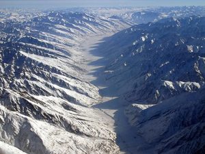
The Wakhan Corridor has been the most important junction point of the Silk Route since its inception. The corridor has long been used as a trade route by Europeans and Chinese to reach the Indian Plains and the Indian Ocean’s Sea Lines of Communications through the Arabian Sea Coasts or even connecting the Persian Gulf & Inner Mongolia.
While the basic geography of these routes has long been studied, largely identified by historical sites along the way, the specific details about why these roads pass through mountains and how the connections were formed has not been as clear.
Researchers think they’ve found a way to explain the origins and importance of the mountain routes for these roads, routes that are essential for overland journeys between Europe and Asia. They may have originally been the paths that nomadic societies traveled with their herds across the highlands, seeking out the best places to graze along the way, according to a study published in the journal Nature. Without those nomadic herders, it’s unlikely that the paths that allowed travelers like Marco Polo to cross Central Asia would have existed, according to this theory.
The roads that connect cities and towns in lowland regions fit models that researchers had already created. These are based on what seem to be the easiest ways to travel between cities. But the Silk Roads that traverse highlands and rocky mountain ranges cannot be easily explained using an “ease of travel” model.
The new “nomadic herder” model helps solve the mystery.
For over 4,500 years, herders have exploited highland pastures in the summer, when grass resources are rich, and returned in winter to lower elevations where ecological conditions are favorable during colder months,” the authors write in the study.
And in fact, that long predates the major trade routes along those roads. The earliest records for “Silk Road” trade date to around 200 BC, meaning that for centuries before that, these same paths were used by groups looking for places to graze.
Finding the best path
To develop this explanation, the researchers focused on how the routes through the highlands could have been created. They used a modeling system that processes satellite imagery and is frequently used to calculate how water will flow over an area and tweaked that system so it could show how the most fertile routes through the region under study would change over time.
Throughout each year, some parts of the area would work better for grazing land. A model of one year would show the best ways to move animals across that land.
Then, the researchers ran that model 5oo times to create overall “average” routes that would be likely to represent the best way for herders to travel through the highlands. They then checked these routes with the 258 known Silk Road sites within these high altitude regions.
A full 148 sites fell onto the paths they’d modeled. When they made the model slightly more flexible, assuming that people and animals might stray from the “most perfect” paths by about 2 kilometers, a full 192 sites, or 74.4%, matched the routes they’d calculated.
It’s possible, according to this theory, that there could not have been actual Silk Roads connected Europe to Asia without the herding routes that built established paths through the mountains. The fact that 74% of known Silk Road historical sites fall along these paths show how important they must have been — and these models may lead researchers to new and still undiscovered Silk Road sites.