Bentaël “The Daughter of God”
- November 20, 2020
- 0
Prepared By Roy Nader
Cover Image credits: Nick Hobgood
Bentael Natural Reserve
founded in 1981, is one of the first and smallest reserves to be created in Lebanon. It owes its origin to the local will to protect this zone by making the decision to devote a large area of their heritage to form a nature reserve, notably against the projects of urbanization. Bentael Reserve was inaugurated in 1987.
On February 25, 1999 it was officially declared a nature reserve by law number 11. The reserve is managed by the Bentael Nature Reserve Committee of 12 members with Mr. Raymond Khoury as president, under the supervision of the Ministry of Environment, in collaboration with the local communities.
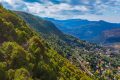
It is located on a south face of a ridge between valleys ,8 km to the east of Jbeil-Byblos, 38 km north of Beirut, and 13 km to Annaya at an altitude of 250 to 800 m above sea level and covers an area of 110 ha.
Bentaël or Bent-IL is a Phoenician expression meaning ” Daughter of God ”
Bentael Nature Reserve designation aims at:
– Protecting the natural environment and its related biodiversity and natural resources.
– Conserving the natural resources (soil, ecosystem and water resources) which include protecting the reserve from pollution and degradation resulting from natural and human induced factors.
– Managing and conserving the reserve in a proper way while ensuring benefits through regulated eco-tourism as long as it does not negate the conservation objectives.
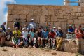
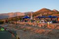
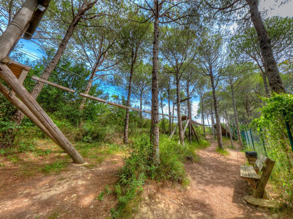
Ecotourism: Locals are well connected to the reserve, and are part of the ecotourism activities as guides, guards or rangers. They also host tourists in the local guesthouses where local products are served. As for the visitors, they can enjoy hiking with local guides, and for families with kids, they can enjoy a lovely day in the Green Shell Eco Adventure Park.
“Green Shell Eco Adventure Park” was launched in March 2015. The premises are run on
solar energy from photovoltaic panels and the wastewater from the restrooms is treated by a wastewater treatment unit. The project premises are accessible for all people including Persons with Disabilities (PWDs). and that contains:
– Library, internet, …
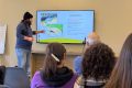
– Information Museum: Briefing sessions on solar energy, wastewater treatment, fire prevention at the reserve. Visiting the herbarium, insectarium and firefighting tool museum.
– Playground for kids: Thrilling for younger kids to swing, slide and seesaw under the pine trees; a place to enjoy a safe and beautiful landscape and have your kids play in nature
– Adventure Eco Park: Exciting six component rope program and climbing wall for all ages with high levels of safety.
When you arrive at the reserve you will be welcomed by a local guard who will present a briefing on the reserve, solar energy, wastewater treatment and fire prevention. He will also help you choose a suitable trail and if needed accompany you for an enjoyable and informative hike, including a tour in the park and the museum and even a lunch in a nearby guest house.
The reserve:
The reserve was designated as an Important Bird Area (IBA) by bird life international in 2008, as it is situated on the line of migratory hawks, eagles and other raptors. It is also considered as a great destination for bird enthusiasts.
30 ha of the reserve is covered with Pine, 70 ha with Oak, surrounded by the river of Bentael which runs along the southern boundary of the Nature Reserve and is dry most of the year. Despite dense forest habitats the reserve consists of 4 Species of Amphibians, 25 Reptiles, 25 Species of Mammals and 650 kind of Insects. With 365 plant Species, 60 of them are medicinal herbs and 2 endemics (Lactuca triquetra; Teucrium montbretti ssp. Libanoticum).
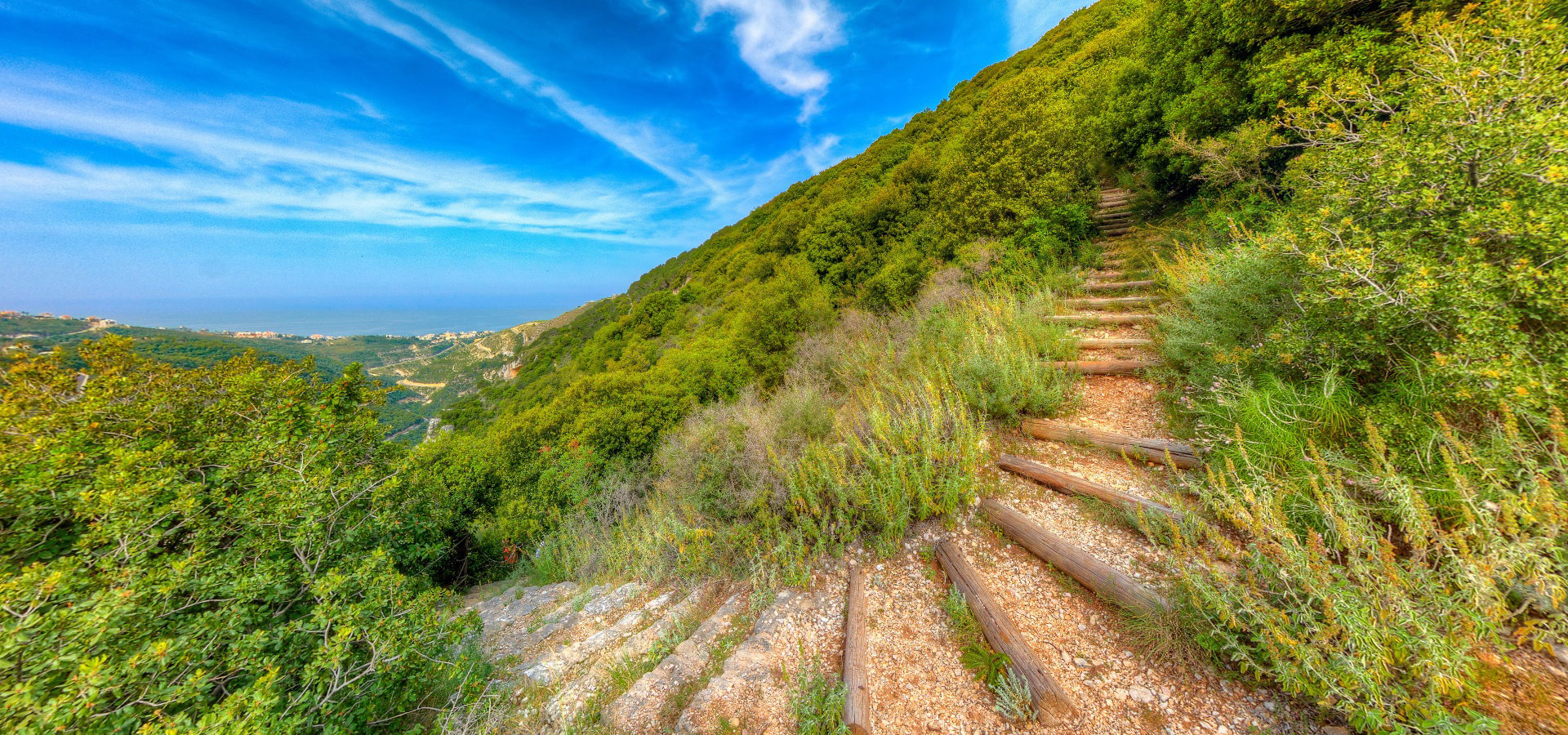
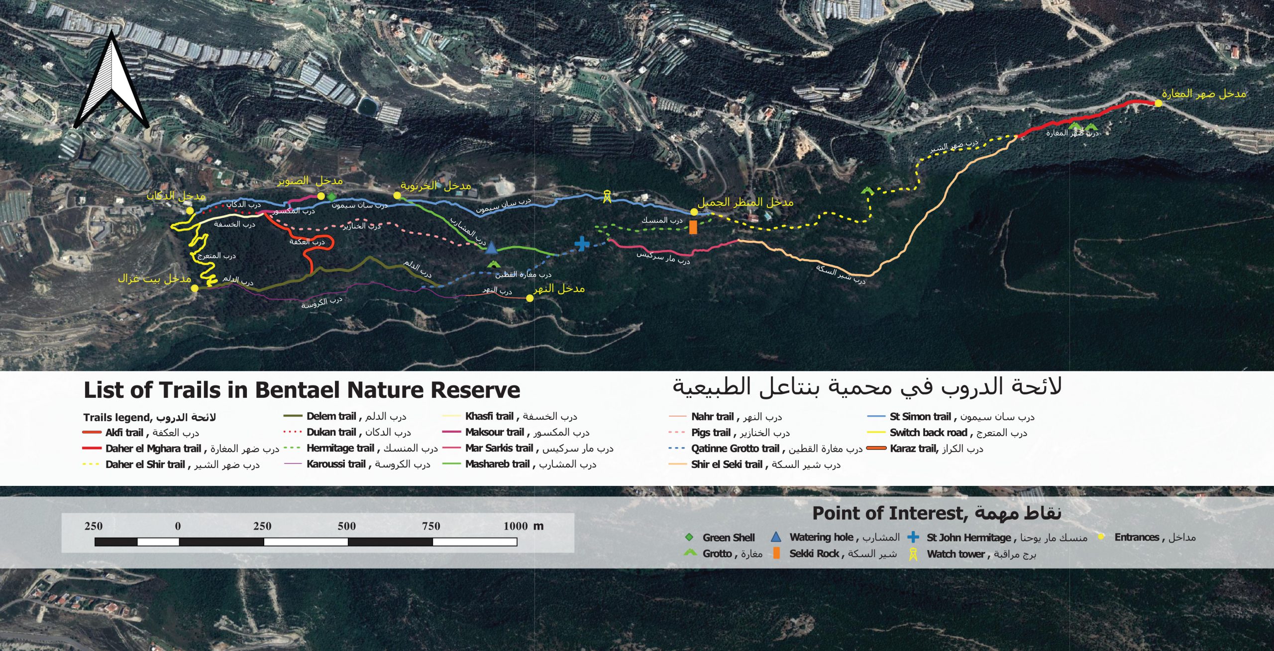
There are 18 hiking trails of more than 10 km (can be completed in a loop). Level of trails depends on choice of the starting point and trails combination. There are 7 attractive views and sites like the Delghani Grotto, Al Hamam Grotto and the hermitage of St. John.
The visitors can find St. John’s rock-cut hermitage and chapel on the Hermitage trail. This 12th century dwelling is located 8m above the ground. Visitors can reach it from the hiking trails. It is composed of three cavities: The first, located approximately 8m from the bottom of the hill, was only accessible by ropes. Researchers believe this cavity was used for habitation and as a refuge in case of attack. The opening to the cave is partially enclosed by a stone wall. The second cavity shelters the remains of St. John’s chapel. The third cavity houses a water reservoir approximately 2.5m deep and 2m wide. It was used to collect rain water.
Let’s take a virtual tour in the Reserve:
Fire prevention
– After being classified as a high danger of fire on the fire danger index, a well-developed firefighting infrastructure has been implemented in the reserve.
– A 140m3 water reservoir connected to more than 1800m of pipe fixed throughout the risk area of the reserve.
– 35 young volunteers have been trained to fight potential forest fires that may spread in the reserve.
– The majority of the fire protection system was implemented by AFD. The pipeline system was recently completed in collaboration with FAO and the NGO Green square.
LRI Project with the reserve
The collaboration started with LRI in 2015 with the implementation of the forest cover expansion in planting 250 seedlings, in the framework of the Firewise program
– In 2018 LRI started to develop and maintain new trails with signs and safety border ropes. The work also includes clearing 22 km of roadsides who is in the high-risk level of fire danger zone and put a plan for prevention to improve the response of any fire that can occur.
![]()
Mobile: +961 3 838 982 /+961 70 100 333 / +961 71 665 474
Facebook: Bentael Nature Reserve
Instagram: Bentaelnaturereserve
Towards Pine Entrance :