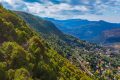
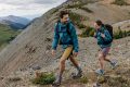
Mount Kneisseh (Canal 11), Tarchich-Kfarselwan loop
- March 21, 2020
- 0
– Mount Kneisseh Canal 11 Trail
- Minimum elevation: 1,700m
- Maximum elevation 2,067m CANAL 11
- Distance: 9 Km
- Elevation gain: 400m
- Starting GPS readings: 33.8632400, 35.8241600 until you reach Channel 11 bldg on GPS readings 33.8400729, 35.7970824 and back from Kfarselwan.
- Distance from Beirut: 24km
- Trail type: Loop
- Difficulty: Medium
#Sannine_range (south and east faces & Zaarour) #Anti_Lebanon range (from North East to South East Lebanon) #Bekaa Valley & #Barouk mountains